Mount Crooke
Friday 5 January 2018
 |
| View of Lakes Seal and Webster from Mount Crooke |
 |
| Windy Moor |
The first part of the walk to Windy Moor is so
familiar to us all, but never loses its attraction though. Once the middle of
the moor crossing was reached we left the track and walked to the waterholes,
which had ample water in them, and then located the main drainage creek of the
area. There was a little concern that it
might be starting to dry up, which would make the planned camping there for the
track workers due to start building a boardwalk there in February a bit dicey,
however the creek had quite a good flow.
 |
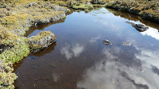
| Creek and pond on Windy Moor |
It was so nice there that a morning drink break was
taken, before heading down Windy Moor to Davis River. Mostly the ground was reasonable
to walk on and it is scenic with well-spaced Richea and other bushes together
with the surrounding wooded ridges and hills.
 |
| Richea scoparia Windy Moor |
Mount Crooke lies beyond the valley of the Davis and
that is where dense patches of Richea and a host of other bushes grow thickly
and make walking quite a bit tougher. Very few people visit, and it is not a spectacular
peak, but it is a pleasant and the views to Lakes Seal and Webster are unique
with the Rodway Range, Mount Bridges and Tarn Shelf as the backdrop. The
immediate surrounds of Crooke comprise snow gums and a high country plateau
devoid of fearsome scrub.
 |
| Mount Crooke summit |
 |
| Snow gum on summit |
The return route taken was more westerly and by luck
the scrub was not as bad. We even came upon a hollow comprising a host of
Pandani (Richea pandanifolia) surrounded by pineapple grass.
On reaching the Davis River again the shorter route
via Lake Fenton was chosen which had the advantage of lessening the distance to
travel to 2.6k from an otherwise 3.6k.
Mt Crooke is named after William Crooke, who was instrumental and a
driving force to have Mt Field declared a nation park. He was often
referred to as the father of Tasmanian conservation and in 1906
promoted the concept of land reservation for the Mount Wellington and Queen's
Domain parks, Hobart, and of wildlife reserves including bird sanctuaries.
Crooke was a keen fisherman and was a regular visitor to Lake Nicholls.
 |
| Route of walk |
The inward route was 6.6k and took 3:15, whilst the return one was 4.3k and 2:05.


Comments
Post a Comment