Skip to main content
Search
Search This Blog
Bushwalks
Descriptions of various bushwalks, mainly in Tasmania
Pages
Home
Links
More…
Posts
Showing posts from 2013
Show all
December 22, 2013
Harry Walker Tier
December 11, 2013
Lake McCoy and Mount Pillinger
November 23, 2013
Mount Direction and Madmans Hill
November 07, 2013
Mount Remus and Back Peak
October 23, 2013
Mount Dromedary
September 11, 2013
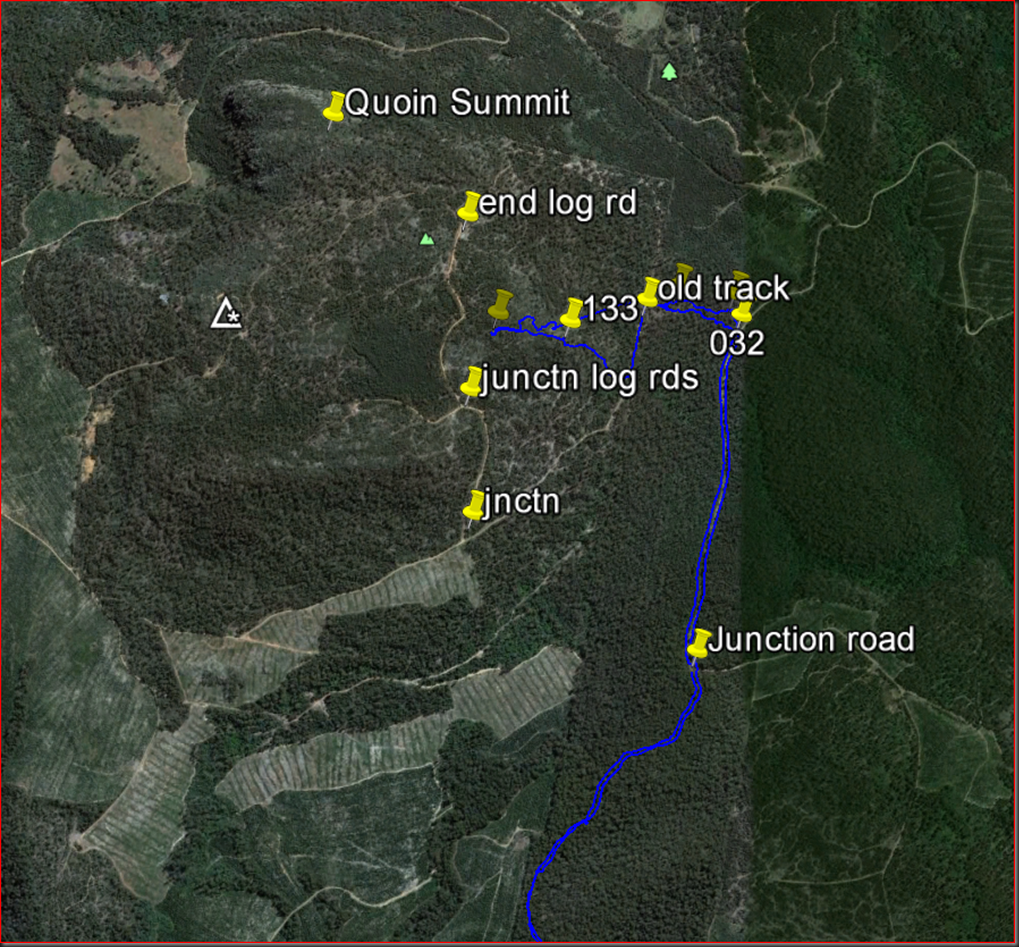
Quoin Mountain
July 07, 2013
Barren Rock and Falls
June 15, 2013
Butlers Hill
June 11, 2013
Collins Bonnet
April 19, 2013
King William 11
April 07, 2013
Mannys Marsh
March 21, 2013
Collins Cap 2013
January 24, 2013
Montagu Thumbs Falls Circuit
Newer Posts
Older Posts
Home