Posts

Showing posts from 2017

Bryans Beach Freycinet Peninsula

Image
8-10 November 2017 Water had never been a problem on a walk to Freycinet, but it was seriously so on this one. Our plan was to camp at a small sandy bay near Hazards Beach and source water from Lagunta Creek, but on arrival there it was not running and decidedly dry. A short way up a shady pool did contain some that didn’t look too bad. Beach and Mount Mayson Sunset on Hazards Bryans Beach with rebuilt  dunes also being eroded Pigface at Bryans Beach Kunzia There was a school group in the camp site and they had collected water from cooks Beach, as did a couple just arriving from there. On the day we headed back there were two people camped and they told us that they went back to the carpark for water when they learnt of the shortage. We left the water to boil rapidly for over 3 minutes and fortunately had no ill effects.  As we were going on a walk to Bryans Beach on the middle day of our stay, a full bladder of good looking water was carried back from Co

Missed and Mist

Image
Adamsons Peak Tuesday 28 November 2017 Any drizzle was expected to be gone by the time we started walking and it was, however the thing that was overlooked was the drenched vegetation left behind.   By the time Manuka Flat had been crossed I was thoroughly fed up with the constant dousing from the wet Bauera and other bushes and was pleased when Greg took over in front. What happened on the next section remains a mystery to me, because somehow, I ended up in front.  Greg B stopped for a drink and I wondered on thinking I was following behind Greg K, but did start to wonder why I couldn’t see any of his boot marks in the mud.  Anyway, I got the plateau, which was in thick mist, but there was no sign of Greg.  I returned to the edge of the plateau and there was Greg just pushing through the thick and wet scrub pressing in on the track; Greg looked thoroughly soaked too.  His first words were “how did you get in front of me.”   A good question, I thought.  It seems that I walk

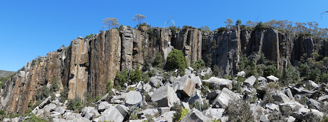
Waratah on Organ Pipes Track

Image
Saturday 25 November 2017 From the Chalet and along the Organ Pipes track where the Waratah were brilliant and at peak flowering. Down the Pinnacle Track and bought lunch from Lost Freight at  The Springs before ascending by the Sawmill to Organ Pipes and on to the car. Telopea truncata Waratah Olearia phlogopappa Organ Pipes Track Olearia phlogopappa More photos here h

Yellow Cliffs

Image
No large waterfalls Tuesday 21 November 2017 Floras Falls As shown in Weekly Courier, August 12, 1905. Note person standing at lower right of falls. Photo: Beattie Copied from “A Brief History of the Waterfalls Of Kunanyi/Mount Wellington“ by Maria Grist 2016 The mystery of Floras Falls was not solved today, but a couple of potential locations were eliminated. It was accurately predicted to be a warm day, so we started out a little earlier and it proved beneficial. Our first spot to check to see if a waterfall existed was at a large sandstone cliff to the east of Glen Dhu Rivulet, but although at first sight it looked promising there was no creek and no real sign of a waterfall. Cliffs on eastern side of Glen Dhu Rivulet Yellow cliffs  Glen Dhu Rivulet After leaving there we descended to Glen Dhu Rivulet and found it had ample fresh running water and the temperature decidedly pleasant. All too soon we were on the climb through the woodland, heav

Lost World Mount Arthur

Image
Tuesday 14 November 2017 Quite a hot day, but it wasn’t until we got down to lower altitudes in the afternoon that it was particularly noticeable.  Nevertheless, we sweated a good deal from the start of the walk. Lost World at Mount Arthur Once above the sandstone cliffs on the Old Hobartian track the golden rosemary and cheeseberries were in abundance and delightful. It was good to reach the Lost World as that signalled the end of the up for a while and a break for lunch. First though we explored a fissure in the boulders and worked a way into an underground cavern, but a torch would be needed to explore further and probably a rope ladder. Golden Rosemary  Oxylobium ellipticum - Golden Rosemary Resting at Mount Arthur Cyathodes glauca  - Cheeseberry Large Eucalypt Lunchtime entertainment was watching rock climber attempt to scale a cliff, but he hadn’t made it to the top by the time we departed. On reaching the road the choice made was to walk o

Shadow Lake 2016

Image
12-14 April 2016 We had a few days kept free for a walk and, as it was the first one for Sue since her eye troubles, we decided not to overdo the April  pack carrying by choosing Shadow lake as the camping location. It was most satisfying that the weather was predicted to be really good giving us encouragement to go. On the drive to Lake St Clair we made a few geocaching diversions and then set off after lunch for Shadow Lake. The weather went as predicted and our middle day was just superb as was the scenery during a circuit walk of Mount Rufus. The valley from Shadow Lake to the Hugely Rufus saddle is wonderful and made all the more so in sunny calm conditions. The circuit took 6:30 hours for the 13.7k and we did think that the trees grown since the devastating fires of the 1960’s were now big enough to hide a lot of the dead stuff of which some trunks would also now have fallen. The walk through the forest on the connecting track brought us past a huge and impressive eucalypt.

Lake Skinner

Image
Friday 27 October 2017 Lake Skinner This trip was the first time on the upgraded track to Lake Skinner and the wet and muddy spots now have timber to cross over them.  It is a mixture of long vertical split logs and short split log cording put down sideways; a traditional method used by Environment Tasmania when the organisation did the upgrade in 2015. Despite now being able to avoid the mud, we took longer than before get to lake Skinner.  However, the day was pleasantly warm and sunny very little wind and the forest was delightful. Lake Skinner consequently was about as nice as it gets. One irritant was a party of young people who brought a dog with them, which of course is not permitted. As we departed the dog must have seen us and barked loudly, giving both of us quite a startle. Lake Skinner shoreline Time in 2h Time out 1:45   Distance 3.5k each way  total 7k More Photos here

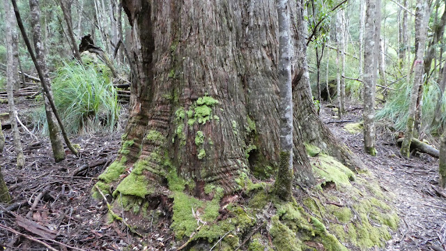
Pinestone Valley 2017

Image
15 - 18 October 2017 It now takes a bit longer to get to Pinestone Valley than once and I feel sure it that is somewhat more tiring as well.  Nevertheless, the destination was reached. The track up from arm River now winds its way up via a series of zig zags, making for a much less steep ascent.  The track into the valley under Mount Pillinger was used and we climbed the mountain on the way through to a camp at Wurragarra Creek. It was calm and sunny and there was an added privilege to see an eagle at close range.  The route up was different from my memory as it goes up to a plateau on the eastern side and I had walked across it from Lake McCoy in 2013 and wondered why we came upon a pad and a sawn log; not realising it was the actual Pillinger track. Mount Pillinger In fine weather we left Wurragarra soon after 8AM and made it down to Pelion hut, disturbing two Tiger Snakes on the way; our third for trip so far.  However, we were all found it an effort getting to Peli