Posts

Showing posts from June, 2018

Huntingdon Tier

Image
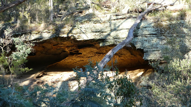
Tuesday 19 June 2018 Huntingdon Tier is a sandstone hill area just east of Harry Walker Tier but is predominantly private land. Some cliffs and rock formations are visible from a distance and the walk went to some of these. Locations were picked out after looking at a map and satellite images and one of the first of these was a narrow gully penetrating well into the tier. This spot turned out to be the highlight of the walk. Fretted overhang roof As we approached what seemed to be a cliff was visible through the trees and on getting closer the scene became impressive, with large overhangs and caves on the other side of the gully. Descent to the floor of the gully passed cliffs as we crossed through deep green mossy rocks under Pomaderris to the cliffs.   This side the sun was warm and lighting all the features. It was a short scramble to get to the floor of the largest cavity and from there we went further up the gully passed other caves and ascended to the clifftops.
Tanina Bluff

Image
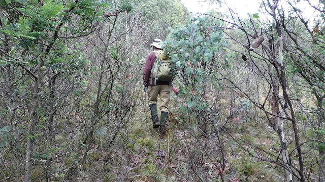
Tuesday 12 June 2018 Dave had been to Tanina Bluff before and knew the spot to head off.      Initially logging tracks were followed then it was up through the bush. The early parts were not particularly attractive bush and a little scrubby. The upper part of Tanina Bluff was rocky still with a bit of scrub though. Scrub on the way up Lichen on boulder Eucalypts on summit in mist Quite recent tapes were present for the trip plus rock cairns. We managed to find a sheltered spot for morning break and an even better one under an overhang for lunch, which was on our way down. The walk was 5.7 k return and with an elapsed time of 4:36 or 3:15 walking time.

Echo Sugarloaf

Image
Sunday 10 June 2018 With such a nice day expected we made plans to visit Echo Sugarloaf.   As it is only a short walk   we had plenty of time to stop for a coffee at Cygnet, and also made the walk slightly longer by starting at the western end of Randalls Bay.   It proved to be a good decision as there is no parking where the track starts. Echo Sugarloaf from Randalls Bay Dam Pond   passed on the way Randalls Bay from Echo Sugarloaf The reserve is 122 hectares and was donated to the state by local farmers, Max and Bev Thomas, for the protection of endangered species. Randalls Bay Landcare built a track which opened in 2018 and climbs quite gently most of the way by following the contours of the area. It does result in being about 300 metres distance from the top near the start but by the halfway mark you are 700 metres away.   A pond with a well constructed platform is passed on the way. Our version of the walk was 6.3k and took 1 ¾ hours of walking. There i

Spring Beach to Orford

Image
Monday 4 June 2018 It seemed likely that the east coast would have pleasant weather and that proved to be the case. A relatively short walk from Spring Beach to the bridge at Orford was chosen and it gave us time for a coffee stop at Sorell and lunch at the café at the turn around point. The early part of the walk is within mostly bushland, even though some dwellings are not far away.  This section includ Cliffs north of Spring Beach Quarry wall Three Thumbs from Orford Beach es the old sandstone quarry, which now has a nice set of rock steps to get to the bottom of it. As Shelly Beach gets closer so does lots of houses, mostly holiday ones by the look of the blinds covering the windows and lack off people. Nevertheless, it was a pleasant walk in such calm and sunny conditions. Total walking time, including the quarry visit was 3:20 and a shade over 11k