Posts

Showing posts from 2021

Monash Valley

Image
Tuesday 28 January 2021 Last summer the Scoparia was disappointing, but the signs were much more promising this year. The planned location was Monash Valley an unofficial name of a spot below the mountain of that name. After a number of years using different approach routes, I now have the least scrubby way of getting there. The start is over Wombat Moor which has lots of attractive Boronia in flower at this time of year along with Epacris. Fortunately, a bush with colourful flowers was observed at the start of the walk, which gave us hope and this was born out when the valley was reached.  Epacris serpyllifolia on Wombat Moor   Telopia truncata     Waratah   Richea scoparia   Richea scoparia     Richea scoparia  For more photos go to this site

Mount Rufus 2020

Image
Wednesday 30 December 2020 Our aim was to visit the high valley between Mounts Rufus and Hugel where the scoparia can be quite spectacular, however the flowering was disappointing. We did it is a day walk from Cynthia Bay and went via Shadow Lake as we were undecided whether to walk to the valley and then return the same way or complete the circuit. With a very disappointing scoparia flowering we had more time available and decided to continue on to Mount Rufus, the weather was ideal making that option a good idea. Just before the summit we decided to cut across and bypass it, thus saving a bit of climbing. All up it took 8 hours for the almost 20k and we were quite tired by the finish.  Shadow Lake         Valley floor and Mount Rufus Boronia citriodora ------------------------- A photo album can be viewed from here or click the image below   Mount Rufus Circuit

Chauncy Vale Cliffs November 2021

Image
Tuesday 9 November 2021 Unfortunately, Dave was not able to come on the walk, but the route he suggested was known and I think followed.    After walking to a junction, I turned on to the right-hand track without taking any real notice of the sign and had gone nearly 200 metres before it dawned on me that we were going in the wrong direction, so a bit of backtracking was required.   After ascending to the top of the cliffs we walked to the eastern end and dropped down further than the last occasion, until we were under a large cliff.  After a short distance the huge height of the cliff became apparent, and we also became aware of the noise of falcons flying overhead that were clearly disturbed by our presence.      The white droppings way up the cliff were noticed and it looked like the site had been used over a period of many years.  We moved on and again came upon a falcon site, but the birds were not so annoyed, nevertheless we continued on to leave them in peace. A gully, with a lo

East Risdon Reserve

Image
Tuesday  26 October 2021   There are a number of tracks in the East Risdon NR and adjoining land. The route chosen was 8.5k and took a shade over 4hours, including lunch. Many of the Euc risdonii were in flower and numerous smaller plants as well, in particular the great quantity of Stackhousia were splendid; I've never seen so many before. The day started out cloudy but eventually it opened to a mostly sunny mild day . Photo Album     Orchid    Photo Greg Bell   Euc risdonii in flower   Stackhousia monogyna   Oleria     There is a photo album online.

Mount Connection

Image
Tuesday 12 October 2021 From Pulpit Rock  with  view to Mount Montagu The start along the Big Bend Fire Trail is now nicer to walk on than in prior years. Once at the junction with the walking track it becomes nice walking country. We stopped at the copse of trees part way over the plain of the headwaters of Mountain River, where there is a rather pleasant open spot amongst the trees. From there the track sidles up the top of Mount Connection. At this point the track was left to visit The Lectern and then Pulpit Rock ,all in nice alpine vegetation including snow gums,. As always the return part that on the ascent of the fire trail was tedious and felt like the hardest bit of the walk. All up it was 10.3k 5:40. Collins Bonnet A photo album is here. Route profile For some strange reason when the data from the phone app is downloaded the distance is not correct. it is 10.3k   and not the 11.2 shown above Route from track to The Lectern and Pulpit Rock    

Mother Browns Bonnet 2021

Image
Tuesday 28 September 2021 It was a pleasant Spring day with very little wind and ample sunshine. Initially we walked, around the buildings, peering through the windows. Although lots of Spanish Heath was visible it seemed to cease once we got into the bushland, fortunately or perhaps from the efforts of the Wildcare group that work at Woodvine. Flowers were good and especially wattles in damper gullies and a low growing species on the top of Mother Browns Bonnet. The open grassy areas near the top were also striking and it is assumed were natural due to thin topsoil.  Hibbertia Edge of an opening on the top Dense low Wattle  on summit area of Mother Browns Bonnet More Photos here.

Chauncy Vale Sept 2021

Image
Thursday 23 September 2021 The walk was the Guvys Lagoon returning via the caves.   The lagoon for once was filled almost to the maximum.  After morning tea near there we retraced our steps to the caves junction and walked back to the start that way.   Although it was a windy day, it was not a lot of it getting into this sheltered valley.  The calm water in the Guvys Lagoon photo testifies to that.   Just a few hundred metres in from the entrance to Chauncy Vale Wildlife Sanctuary there is a building with wide verandas and  we had a barbecue here.  Towards the end of the meal the sun got blocked by clouds and  a cool breeze encouraged us not to linger.   Guvys Lagoon Sticky  Boronia (Boronia anemonifolia ) A photo album is here.

Caves and Flagstaff Hills August 2021

Image
 Tuesday 17 August 2021 A walk was planned to go to the ice houses on the mountain, but I should have taken a bit more notice of the weather forecast for the prior days, which predicted snow. The venue was changed to Caves Hill, also known as Rocky Tom, and on to Flagstaff Hill. The snow did eventuate and we got several views of it on our walk, which was in delightfully sunny conditions.   From Geilston Gully  the 11.3 circuit took 4:40 including lunch. Caves Hill/Rocky Tom Wellington Range from Flagstaff Hill Cliff at Caves Hill There is a photo album here.

Chauncy Vale Cliff Circuit

Image
Tuesday 10 August On a walk to Butlers Hill in 2013 we retuned by going under the cliffs at Chauncy Vale.   As it was interesting and enjoyable, I decided it would be good to do a partial repeat by going on a circuit of the cliff section.  It entailed ascending to the top of cliffs at the western end and walking over what is pleasant open country to the eastern end of the main cliffs.  At this point a descent can be made to a shelf running along the mid level back to the western end, passing many caves on the way.  Cliffs at Chauncy Vale After finding a way to the top of the cliffs we were presented with lovely bush dominated by blue green Eucalypts, possibly E tenuiramis.  Once at the eastern end of the cliff line only a short drop took us below the cliff and from then on it was a most delightful slow walk along a good ledge.  There were numerous caves along the cliff line, and even better than I remembered. The normal track to Browns Cave was taken back to the cars, passing two recen

Chalet to Pinnacle Kunanyi

Image
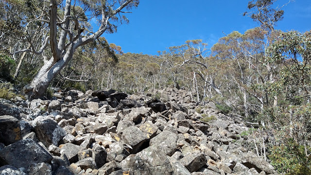
 Tuesaday 10 November 2020 Scree above old track I recently walked along the old benched track above The Chalet on kunanyi and noted some cairns that very likely was the route marked by David Hardy about 20 years ago, to near the top of the mountain. There was also a route marked by Snapper Hughes in the region, at the behest of the land managers, for a planned track to the summit to create a circuit walk. This was put to one side because of other priorities, but I have contacted the City of Hobart suggesting it be resurrected. Out of curiosity I went with Greg B to discover if the route could still be followed. Cairn marking route up scree slope   Location of pad which is still visible Mount Arthur and Lost World At the end of the old benched track there were some cairns, most of which seemed old when checked under the top rock. It was hard to know if they had been there for 20 years though. Old cuttings were eventually reached and there was obvious wear on the ground in parts.