Chalet to Pinnacle Kunanyi
Tuesaday 10 November 2020
 |
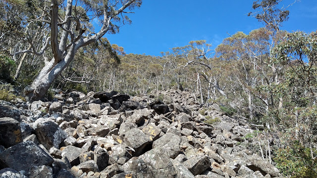
| Scree above old track |
I recently walked along the old benched track above The Chalet on kunanyi and noted some cairns that very likely was the route marked by David Hardy about 20 years ago, to near the top of the mountain. There was also a route marked by Snapper Hughes in the region, at the behest of the land managers, for a planned track to the summit to create a circuit walk. This was put to one side because of other priorities, but I have contacted the City of Hobart suggesting it be resurrected.
Out of curiosity I went with Greg B to discover if the route could still be followed.
 |
| Cairn marking route up scree slope |
 |
| Location of pad which is still visible |
At the end of the old benched track there were some cairns, most of which seemed old when checked under the top rock. It was hard to know if they had been there for 20 years though. Old cuttings were eventually reached and there was obvious wear on the ground in parts. After ascending 130 m in height over a line distance of 200 metres, although the actual walking covered 400 metres, we arrived at a junction.
The intention was to head to the summit area and the pad leading that way was taken. It followed a vegetated bench and the pad was mostly still obvious, although we found a few spots that needed a bit of searching. There were occasional yellow marking tapes, and we were again uncertain if they could be 20 years old, if so, they have lasted remarkably well.
This part of the route did not involve steep climbing and would have been easy going if not for the scrub here and there getting in the way. After about 1:25, excluding a break and 1.5k the road was reached, and we crossed over to the summit plateau and walked on to the south west lookout platform. From there it was down the Zig Zag and along the Organ Pipes tracks back to The Chalet.
 |
| Summit plateau |
 |
| Organ Pipes |
Total inc lunch morning tea 4:15 6.2k
 |
| Route from Chalet to Pinnacle The part above the road was untracked |


Comments
Post a Comment